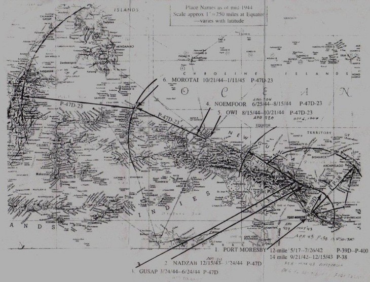
Chockie,
here is a map of New Guinea and the air strips that the 39th used with
dates and type of planes we flew. Dates from Port Moersby to Moratai. If
you blow it up, it is more readable. More later as I search my
hard drive. Lewis Lockhart.
Lew,
this is a wonderful map! I'm sorry that the web picture isn't any
larger but if our readers will copy it in "landscape mode" and then
print it, it will be much easier to read.
For
the rest of you out there, I'm still working on the layout problems of
this site, but more and more technical problems get solved every day!
Be a part of writing down history and send us what you have!
-cbs